MRP: Bishop's Palace
Dallison family house, Bishops palace (or place), Halling, Kent
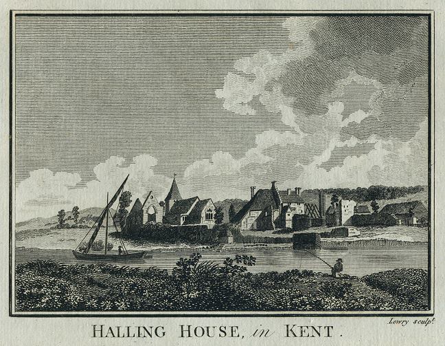
The Bishop's Palace or Place lay in the centre of the village of Lower Halling off what is now called Ferry Road. It bordered the northern bank of the River Medway, and overlooked marshes to the south. Presumably a ferry linked the two banks of the Medway at this point, since here the modern river is particularly narrow, as it turns with a sharp kink on the way from Snodland towards Chatham, Strood and Rochester. The topographer William Ireland, writing in 1830, commented on the unhealthy situation of Lower Halling in comparison with the nearby village of Upper Halling, which was built on higher ground half a mile further west. He suggested that the place was rendered "far from healthy and pleasant" as a result of the quantity of salt and freshwater marshland which lay between the chalk uplands and the River Medway. The land was not of high quality, being largely of chalk.
Several early seventeenth century legal documents comment on the poor condition then of the buildings of the Bishop's palace, which stood close to the parish church. Ireland states that in 1715 "a great part of the ruins remained, viz. the chapel, the hall, and a gate, with the arms of the see of Rochester in stone; in which state the fabric continued till within memory, but has since been destroyed for the sake of the materials."

‘Halling House, Kent’, engraved by Lowry, published in Picturesque Views of the Antiquities of England & Wales, 1786. Copper engraved print, good condition. Size 17.5 x 13.5 cms including title, plus margins. Digital image is courtesy of antiqueprints.com
A series of chancery records in the first half of the seventeenth century chart the financial problems of the Dallison family as it struggled with the lease on the Bishops Palace and associated lands. The Palace and lands were held by lease from the Bishop of Rochester.
See [- Map of North Weald Houses]
Sources
C 2/Eliz/D1/45, C 2/Eliz/D2/45, C 2/Eliz/D5/59, C 2/Eliz/D6/57, C 9/49/48
Letter from Henry Oxinden (?of Barham) to John Warner, Bishop of Rochester, April 17th 1643, MS. 28,000, f. 243, printed in Dorothy Gardiner, The Oxinden and Peyton Letters, 1642-1670, being the Correspondence of Henry Oxinden of Barham, Sir Thomas Peyton of Knowlton and Their Circle (London, 1947), pp. 14-15
Images
Plate of engraving of the ruins of the episcopal palace of Halling, between p. 270 & 271, in W.H. Ireland, England's topographer: or A new and complete history of the county of Kent, vol. 4 (London, 1830)
- ‘Halling House, Kent’, engraved by Lowry, published in Picturesque Views of the Antiquities of England & Wales, 1786. Copper engraved print, good condition. Size 17.5 x 13.5 cms including title, plus margins