Difference between revisions of "MRP: The River of Thames"
| Line 23: | Line 23: | ||
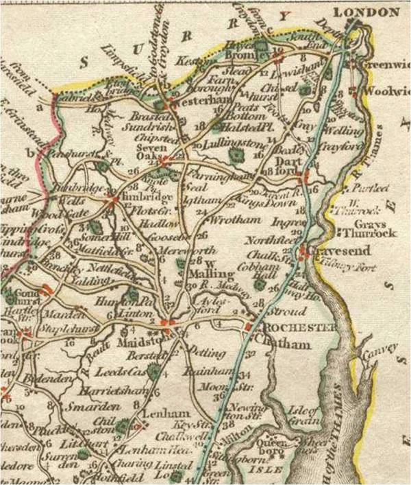
===North Kent and River of Thames, Detail from Kent, Cany, 1814=== | ===North Kent and River of Thames, Detail from Kent, Cany, 1814=== | ||
| − | [[File:MAP_DETAIL_London_To_Canterbury_Cany_1814_DL_CSG_010112.jpg|thumbnail| | + | [[File:MAP_DETAIL_London_To_Canterbury_Cany_1814_DL_CSG_010112.jpg|thumbnail|600px|none]] |
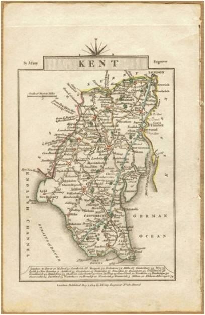
===Kent, Cany, 1814=== | ===Kent, Cany, 1814=== | ||
| Line 52: | Line 52: | ||
==Notes== | ==Notes== | ||
| + | ===Description of River Thames, Robert Pocock, 18XX=== | ||
| + | |||
| + | "Monday, 27th. [YEAR?] Went from Chatham by coach to (Upper Blue Bell) and had from the top of the house an extensive view, as we saw the road (plainly) going up Shooter's Hill (about twenty-four miles distant), and Lord Petrels house, near Brentwood, Essex (thirty miles off), the towns of Southend and Leigh in Essex (about twenty-five miles), the town of Sheerness with Minster in Sheppy, the Nore and ships sailing down the Swin; to the south Cox's Heath; and south-west a fine prospect of a campaign valley with the hills of Surrey....Slept at the Swan"<ref>George Matthews Arnold, ''Robert Pocock, the Gravesend historian, naturalist, antiquarian, botanist, and printer'' (London, 1883), pp. 134-135</ref> | ||
| + | |||
| + | ===The Hope, past Gravesend, leaving the Thames=== | ||
| + | |||
| + | The Hope is the first reach after Gravesend reach as a ship makes its way out of the Thames<ref>'Directions for the River Thames, from London to the Nore' in John Chandler, ''The new seaman's guide, and coaster's companion'', pts. 1-3, (London, 1809), pt. 1, p. 6. See http://books.google.co.uk/ebooks/reader?id=a7QBAAAAYAAJ&printsec=frontcover&output=reader&pg=GBS.PA6, viewed 03/01/12)</ref> | ||
| Line 65: | Line 72: | ||
[http://www.1st-art-gallery.com/thumbnail/106228/2/A-General-View-Of-The-City-Of-London-And-The-River-Thames,-Plate-2-From-$27views-Of-London$27,-1794.jpg 'A General View of the City of London and the River Thames,' plate 2 from 'Views of London', 1794, a painting by Thomas Bowles] | [http://www.1st-art-gallery.com/thumbnail/106228/2/A-General-View-Of-The-City-Of-London-And-The-River-Thames,-Plate-2-From-$27views-Of-London$27,-1794.jpg 'A General View of the City of London and the River Thames,' plate 2 from 'Views of London', 1794, a painting by Thomas Bowles] | ||
| + | ===General=== | ||
| + | |||
| + | Farrington, J, ''A history of the river Thames'' (XXXX, 1810) | ||
| + | - Note: "John and Joseph Boydell's landmark in English topography, A History of the River Thames. Engraved by Stadler, J. C." | ||
| + | - Illustrations of interest include: | ||
| + | * 'Rochester bridge, and castle' | ||
| + | * 'Maidstone' | ||
---- | ---- | ||
==Suggested primary sources== | ==Suggested primary sources== | ||
| Line 73: | Line 87: | ||
==Suggested secondary sources== | ==Suggested secondary sources== | ||
| − | + | Chandler, John, ''The new seaman's guide, and coaster's companion'', pts. 1-3, (London, 1809) | |
| − | + | ||
| − | - | + | |
| − | + | ||
| − | + | ||
XXXX, XXXX, ''A History of the River Thames'' (XXXX, 1795) | XXXX, XXXX, ''A History of the River Thames'' (XXXX, 1795) | ||
Revision as of 11:46, January 3, 2012
The River of Thames
Editorial history
01/01/12, CSG: Created page
Contents
[hide]Suggested links
See Blackwall
See Gravesend
See Greenwich
See Limehouse
See Redrith
See Woolwich
See The River Tapti
Images
North Kent and River of Thames, Detail from Kent, Cany, 1814
Kent, Cany, 1814
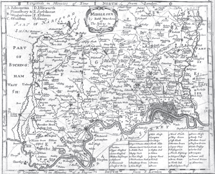
Middlesex, Robert Morden, 1704
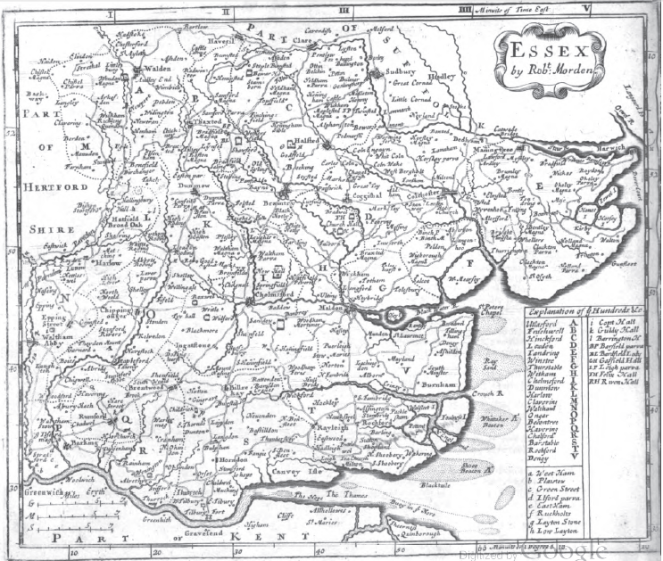
Essex, Robert Morden, 1704
Image credits and copyright information
(1) Detail of north Kent and river of Thames from 'Kent,' Cany (XXXX, 1814)
(2) 'Kent,' Cany (XXXX, 1814)
(3) Morden, Robert, 'Middlesex,' Plate, The new description and state of England, containing the maps of the counties of England and Wales, 2nd edn. (London, 1704), betw. pp. 45 & 46
(4) Morden, Robert, 'Essey,' Plate, The new description and state of England, containing the maps of the counties of England and Wales, 2nd edn. (London, 1704), betw. pp. 24 & 25
Profile
Notes
Description of River Thames, Robert Pocock, 18XX
"Monday, 27th. [YEAR?] Went from Chatham by coach to (Upper Blue Bell) and had from the top of the house an extensive view, as we saw the road (plainly) going up Shooter's Hill (about twenty-four miles distant), and Lord Petrels house, near Brentwood, Essex (thirty miles off), the towns of Southend and Leigh in Essex (about twenty-five miles), the town of Sheerness with Minster in Sheppy, the Nore and ships sailing down the Swin; to the south Cox's Heath; and south-west a fine prospect of a campaign valley with the hills of Surrey....Slept at the Swan"[1]
The Hope, past Gravesend, leaving the Thames
The Hope is the first reach after Gravesend reach as a ship makes its way out of the Thames[2]
Suggested image sources
Small scale
'Fig. 5: A chart of the estuary of the River Thames by John Seller based on the survey by Sir Jonas Moore', in N.J.W.Thrower (ed.), The Compleat plattmaker: essays on chart, map, and globe making in England in the seventeenth and eighteenth centuries (Berkeley & Los Angeles, 1978), p. 144
Thames at London
General
Farrington, J, A history of the river Thames (XXXX, 1810)
- Note: "John and Joseph Boydell's landmark in English topography, A History of the River Thames. Engraved by Stadler, J. C."
- Illustrations of interest include:
- 'Rochester bridge, and castle'
- 'Maidstone'
Suggested primary sources
Suggested secondary sources
Chandler, John, The new seaman's guide, and coaster's companion, pts. 1-3, (London, 1809)
- Jump up ↑ George Matthews Arnold, Robert Pocock, the Gravesend historian, naturalist, antiquarian, botanist, and printer (London, 1883), pp. 134-135
- Jump up ↑ 'Directions for the River Thames, from London to the Nore' in John Chandler, The new seaman's guide, and coaster's companion, pts. 1-3, (London, 1809), pt. 1, p. 6. See http://books.google.co.uk/ebooks/reader?id=a7QBAAAAYAAJ&printsec=frontcover&output=reader&pg=GBS.PA6, viewed 03/01/12)


